
Smartphone imagery platform
Capture and document any space, inside and out.
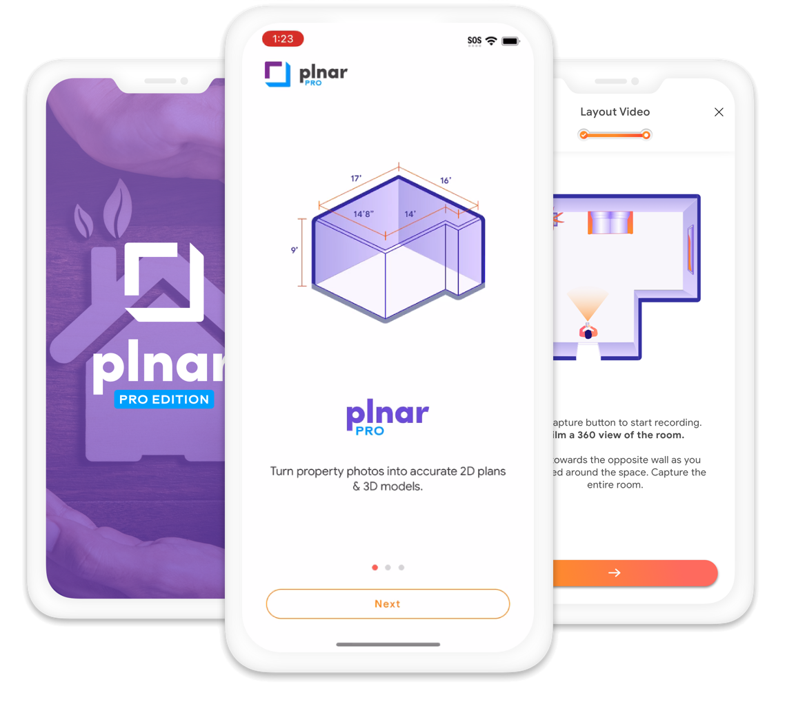
Plnar’s AI-powered platform turns smartphone photos into detailed spatial records, including precise floor plans, 3D models, and estimate-ready measurements. Property documentation gets faster, costs come down, and claims move forward.
30-day free trial. Mobile app for capture, web portal for your team.





#1
In claim 3D modeling
Top 100
Carriers trust Plnar
98%
Unmatched precision
How it works
From the first photo to an estimate-ready file.
Plnar connects capture, measurement, and estimating so documentation is accurate and consistent whether it happens virtually or onsite.
01
Capture
Guided smartphone capture of interiors and exteriors, by a field pro or the policyholder.
02
Understand
AI builds floor plans and 3D models and identifies openings and room features.
03
Scope
Measure surface area, volume, and perimeter from measure-ready imagery, and tag damage.
04
Estimate
Send sketches to Xactimate or Cotality Estimate, with ESX and FML outputs.
Capture
The phone in your pocket is the only hardware you need.
Pick the capture method that fits the job. Every method feeds the same project and the same outputs.
Interior
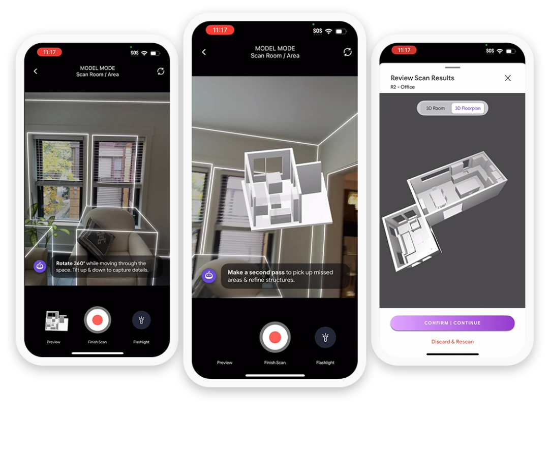
Instant LiDAR-Sketch or Photo-Based Capture.
Scan a room and start the estimate before you leave, or capture photos on any supported phone.
- Instant Sketch: sketch and model ready instantly on a LiDAR-equipped iPhone or iPad
- Photo-Based Capture: any supported smartphone, quality-inspected models within 24 hours
- Measure anything later, with no return visit

Exterior
A guided workflow for complete exterior coverage.
Walk the property with step-by-step guidance so every elevation is documented the same way.
- Guided elevation capture for every side of the structure
- Photos organized by elevation for the reviewer
- SnapShot photo documentation included on every seat
Solutions
Any claim, any size, anyone.
Choose how documentation starts: with the policyholder, a field professional, the desk, or a fully managed estimate.

Plnar Snap
Self-service capture at FNOL. Policyholders start from a link, no app account needed.
Explore Plnar Snap →

Plnar Pro
Field capture for adjusters and inspectors, with instant sketches and Xactimate exports.
Explore Plnar Pro →

Plnar Portal
3D models, schematics, and floor plans so estimates can be written from the desk.
Explore Plnar Portal →

Plnar Complete
AI-powered virtual estimates, start to finish, for claims of every size.
Explore Plnar Complete →
Speed meets precision
Estimate-ready outputs from every project.
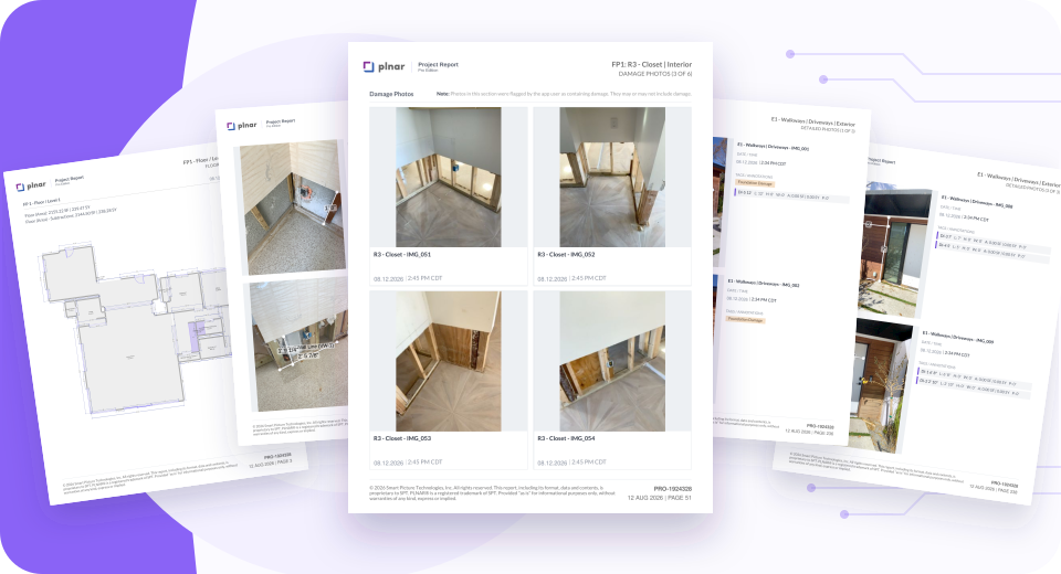
Comprehensive photos, models, and measurements make estimates effortless, so claims settle faster and with precision you can trust.
- 3D model and interior floor plans
- Professional Measurement Report
- Xactimate and Cotality exports, including ESX and FML
- Guided photos with tags and notes on damage
Who it’s for
Built for everyone who touches the claim.
One platform for the people who capture the loss, review it, and pay it.
Insurance carriers
Standardize documentation from FNOL to settlement, reduce site visits, and triage claims with instant insight.
Adjusters and field pros
Capture a room in minutes, get the sketch into Xactimate on site, and measure anything later.
Restoration contractors
Document mitigation and build-back jobs with instant sketches, spatial imagery, and estimate-ready exports.
In the news
What carriers and partners say about Plnar.
Press releases and customer stories from the Plnar team and our partners.

“Source 7’s data available within Plnar makes the combination of technologies a perfect solution to identify otherwise unknown interior risks before they fail, or to identify which ones have the best likelihood of a successful subrogation outcome when things fail and cause property damage,”
– Lyle Donan, Chairman, Source7

“We are excited to partner with Plnar, further enhancing our ability to provide our customers with the industry’s very best level of service, now covering both auto and home,”
– Eliron Ekstein, Co-Founder and CEO of RAVIN.

“Achieving the SOC 2 Type II certification further demonstrates our promise of customer data protection over an extended period of time with robust capabilities to identify, track, and resolve security vulnerabilities.”
– Andy Greff, CEO

Plnar Pro brings our patented smartphone imagery technology to a new audience, empowering claims and inspection professionals with precise, actionable data
– Andy Greff – CEO – Plnar
By combining our proprietary risk and performance data covering over 95% of major household appliances and products installed nationwide, with Plnar’s advanced inspection and 3D modeling capabilities, we are providing insurers with the tools they need to make more informed decisions and deliver exceptional customer service.”
– Brian Webb, President at Source7
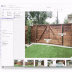
“By embedding precise measurement capabilities directly into the photo capture process, we’re enhancing the accuracy of property assessments and significantly expediting the claims and repair processes for both interior and exterior spaces.”
– Andy Greff, CEO – Plnar

“The right or wrong tech partner can make a world of difference.”
– David Tobias, Forbes Councils Member

“We leverage the latest generative AI, computer vision and machine learning technology to create solutions that are simple for anyone to use and eliminate much of the mundane work associated with handling claims.”
– Andy Greff – CEO – Plnar

“This start-to-finish Virtual Desk Estimates as a Service extending the benefits of virtual estimations to all severity and size claims for all Carriers.”
– the Plnar Team

“With Plnar, customers can gather the same information – with a high degree of precision – when it’s convenient for them. In many cases this means cutting the claim cycle time from days to hours. Everyone wins.”
– Andrew Leeds, Vice President of Claims, Plymouth Rock

“Stop by booth 938 and visit with Adam, Lori, and Rick to learn about The Evolution of Virtual Claims!”
– Scott Lacourse, VP Marketing, Plnar

“The integration of Plnar’s virtual capabilities to our ClaimXperience solution will make it easier for both insurers and consumers to leverage the power of virtual inspections”
– Aaron Brunko, Senior Vice President of Verisk Property Estimating Solutions

“We are excited about integrating with Plnar to enable starting Personal Architect projects from photos. Personal Architect Online is focused on uniting designers, homeowners, and product manufacturers in an online home design environment,
– Chantale Pitts, Chief Revenue Officer at Cadsoft

“By connecting One Click’s already industry-leading platform with (Plnar’s) remote capture and measurement capabilities will be game changing. This solution offers One Click’s users a compelling competitive advantage compared to all other platforms in our space,
– Ryan Lococo, CEO of One Click Contractor

“At the conference, Plnar will be unveiling its new solution, Plnar Insights that, in addition to providing accurately measured 3D models, 2D schematics, and floorplans per elevation; identifies damages, materials, and contents – instantly and automatically – all from smartphone images.”
– Scott Lacourse, VP Marketing | Plnar

“Whereas Betterview gives a comprehensive view of exterior property condition and overall risk, Plnar provides a view of interior property condition. Together, the two products are a huge boost to efficiency, especially at time of claims”
– David Lyman, co-founder and chief executive officer at Betterview

“The integration with Plnar helps further Hi Marley’s mission to protect people simply. This partnership has powerful benefits that make interior claims faster, easier and less stressful.”
– Jay Guden, SVP of Business Operations at Hi Marley

“Our relationship with Plnar is exciting and it is just the beginning of an ongoing agreement to drive the insurance industry forward,” Scott Severe, Senior Vice President, CoreLogic Alliances and Industry Relations.
“Our goal is to deliver an excellent customer experience. Using Plnar to virtually inspect a loss improves our desk-adjusting capabilities and results in quicker claim payments for our customers,” said Lisa St. Onge, Managing Vice President in Amica’s Claims Executive Department.

Plnar has been ranked amongst the top 20 InsurTechs making a difference in the claims space by Strategy Meets Action (SMA). Mark Breading, partner at SMA says: “To gain greater insights into the claims space, SMA has been tracking over 175 P&C claims vendors in the North American market, including 75 InsurTechs (startups initiated after 2010) and over 100 incumbents. This year we set out to identify the Top 20 InsurTechs in Claims.”

Plnar has been ranked amongst the top 12 InsurTech companies in Austin by Texas Best Startup. The companies, startups and institutions listed in this article are all exceptional companies, well worth a follow.

Xactware and Verisk solutions seamlessly connect property insurers to many of the products and services they use on a daily basis to help them work faster and more effectively than ever before,” Xactware President Mike Fulton said. “Now more than ever, it is critical for property professionals to be able to scope and handle claims virtually, improving both efficiency and the customer experience.

“Plnar allows UPC Insurance to incorporate cutting-edge technologies while effectively managing risk and making policyholder self-service a reality” said Chris Griffith, Chief Information Officer and Chief Operating Officer at UPC Insurance. “UPC Insurance is continually evaluating opportunities to optimize technology and connectivity to deliver the superior customer experience that policyholders and agents expect.”

“The use of Plnar has expedited my claims turnaround times and allowed West Bend adjusters to produce accurate estimates to insureds and contractors. I have found measurements to be within one inch of contractor’s measurements and completed in half the amount of time that it takes a contractor to laser measure” said Scott Thomas, West Bend Insurance Director of Claims. “Our adjuster’s Plnar sketch is completed by the time they arrive home from an inspection. The incorporation of Plnar into our adjusting process has taken West Bend to the next level providing service to our policyholders. In today’s world, where people expect rapid delivery, I am able to fulfill that expectation!”

As Plymouth Rock Home’s Vice President of Claims Andrew Leeds puts it, “At Plymouth Rock, we’re always looking for ways to help our customers recover from their losses faster. In the past we’ve relied on physical inspections to gather the scope of loss and measurements of customers’ physical space. But, getting adjusters to customers’ homes takes time and isn’t the most convenient process for our customers who have busy lives. With PLNAR, customers can gather the same information – with a high degree of precision – when it’s convenient for them. In many cases this means cutting the claim cycle time from days to hours. Everyone wins.”

IAG Firemark Ventures General Partner, Scott Gunther, said: “Plnar’s technology has the potential to enhance how we interact with our customers by dramatically streamlining the claims assessment process. In less than two minutes per room, customers and our assessors can capture all the insights they need to determine what’s required to repair the damage.”

“Virginia Farm Bureau is getting high utilization of Plnar from our field staff. Using the Plnar Snap App our field adjusters can limit their time taking measurements onsite and focus more on providing great customer service. With the accurate sketch being available in Xactimate, our adjusters can quickly create their estimate and get a payment to our customer” says Laurie Gannon – Vice President of Claims – VA Farm Bureau Insurance. “Embedding Plnar at FNOL enables policyholders to capture their space, giving insight into the claim so our field staff can determine if an onsite inspection is necessary.

“With the integration of Plnar through the CoreLogic Digital Hub Alliance, we will be able to tap into precise interior property data, context, 3D models and measurements for interior property claims,” said John Langowski, Chief Claims Officer and EVP of Swyfft. “The integration will allow us to identify a variety of resources and collaborations that enhance the customer experience and the efficiency of the adjuster involved in resolving the claim.”
Pricing
Start free. Pay as you go.
Try Plnar Pro free for 30 days. Seat licenses are waived during the trial and $120 in project credits is included.
Get started
Two ways to see Plnar at work.
Talk it through with our team, or try it on your next project.
See it with our team
A live walkthrough of capture, the Plnar portal, and the outputs your team needs.
Request a demoTry it yourself
Start documenting today with a 30-day free trial. Mobile app for capture, web portal for your team.
Try free- 450M+ square feet modeled
- 306k+ platform users
- SOC 2 Type 2 certified